Find out exactly what those sirens are about within minutes. No more wondering or searching social media for information.
Open Map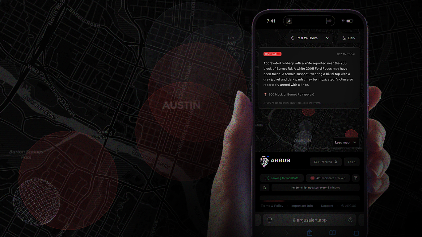

Get specific information about police, fire, and medical incidents in your exact neighborhood - not just citywide alerts.
Open MapCheck if that emergency vehicle is heading toward your home when you're out, giving you peace of mind about loved ones.
Open Map
See at a glance where emergency vehicles are responding with our easy-to-use map interface showing all active incidents.
Open MapOfficial sources rarely provide real-time updates about routine emergency responses. News outlets typically only cover major incidents, leaving you in the dark about smaller events in your neighborhood.
Most incidents appear in our app within minutes of emergency dispatch, giving you immediate information about what's happening as soon as you hear sirens in your area.
We focus on incidents that impact public safety. Our system includes built-in safeguards to prevent interference with sensitive police operations while still keeping you informed about relevant activity.
No! This is a web-based service that works in your browser. Just click the button and it opens instantly - no downloads or installation required.
We've made every effort to make Argus as accurate as possible, but our AI system does misinterpret events and locations approximately 20% of the time. Argus is best used as an additional stream of information rather than a replacement or sole source of emergency information. We strongly recommend verifying anything you see on Argus with other official sources before making critical decisions.
No, we don't have access to every emergency incident that occurs in Austin. The Austin Police Department encrypts many of their communications, limiting our access to the complete source of information. We can only provide updates on incidents that are available through our accessible channels. While we strive to be comprehensive, there will be emergency situations that don't appear in our system.
Know quickly when police, fire, or ambulances are responding in your area, with details about the nature of the emergency.
See exactly where emergency vehicles are heading with our precise incident mapping, so you know if it affects your street.
Quickly check if that emergency response is near your home when you're away, giving you peace of mind about family and property.
Access emergency information within minutes of dispatch, eliminating the delay typically experienced with traditional news sources.
Access our web-based service instantly from any device without downloading or installing anything - just open and use.
Stay informed about emergency situations specific to Austin neighborhoods with localized alerts tailored to your area.
Avoid delays and dangerous situations by knowing about traffic hazards, road closures, and accidents before you encounter them.
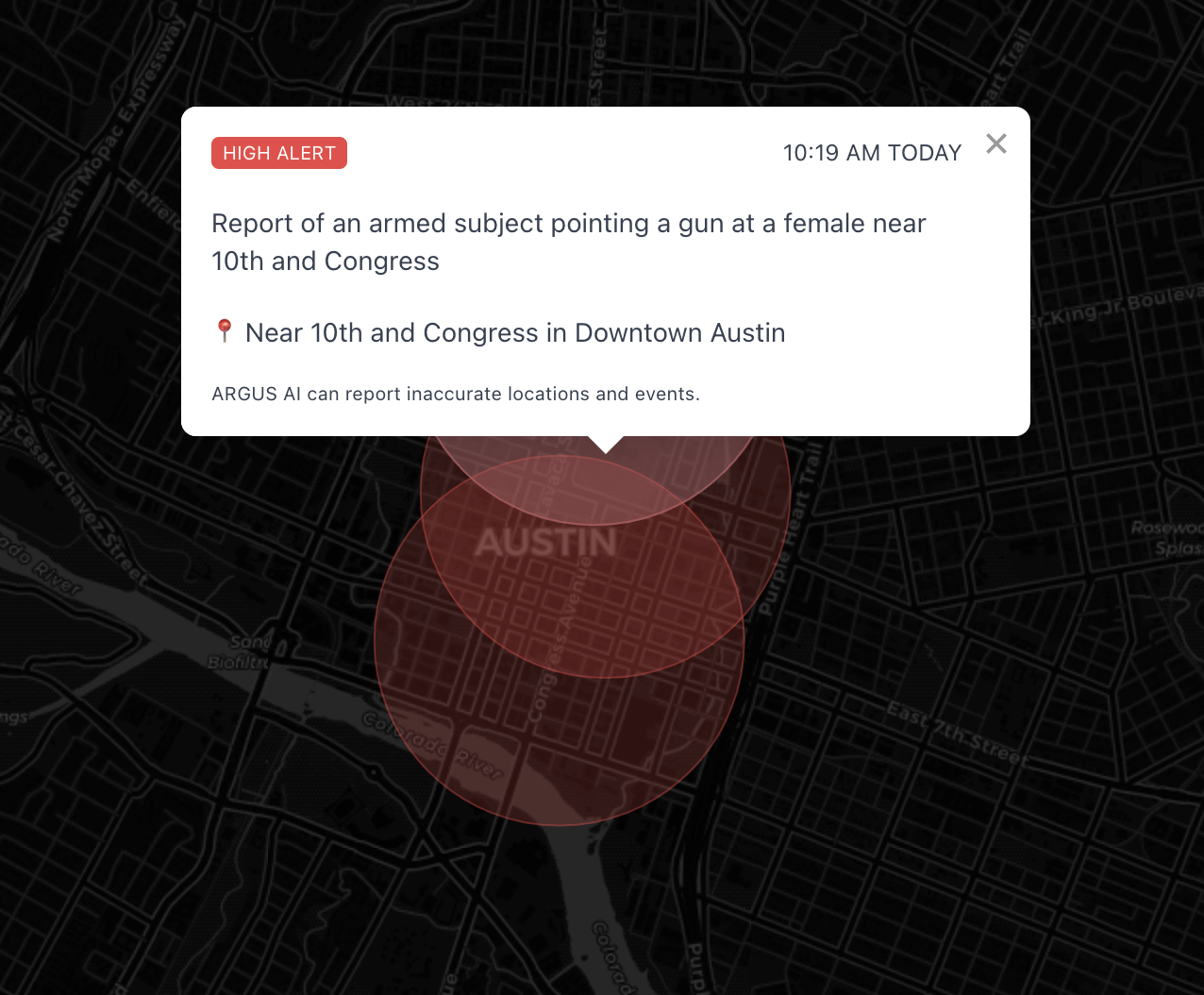
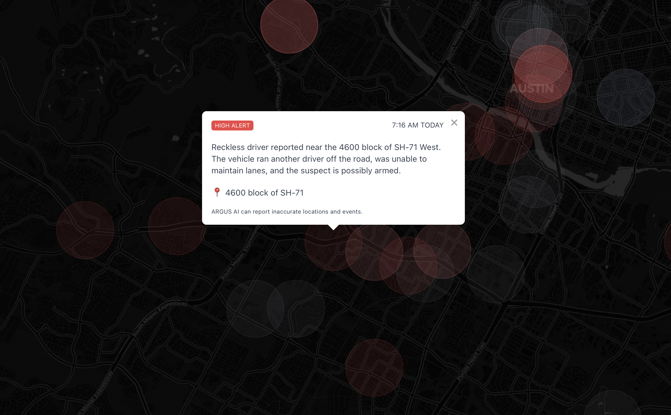
Easily identify the most serious incidents with our priority alert system that highlights high-risk emergency situations.
Keep track of safety concerns in specific Austin neighborhoods with detailed location information for each incident.
Austin's overall crime rate is 20% lower than the national average, with property crime being more common than violent crime. Central Austin and parts of East Austin typically report higher incident rates, while Northwest and Southwest Austin neighborhoods show lower crime statistics. For real-time incident data in your specific area, check the ARGUS map.
Based on police data and resident reports, the safest Austin neighborhoods include Circle C Ranch, Great Hills, Steiner Ranch, Lost Creek, and Westlake. These areas consistently show lower crime rates across all categories. Northwest Hills, Allandale, and Mueller also rank well for safety. Monitor specific incidents in these areas using ARGUS's real-time map.
The safety of each Austin neighborhood varies widely. North Austin neighborhoods like Milwood and Angus Valley report fewer incidents than downtown areas. South Austin's Sunset Valley and Oak Hill are generally safer than East Austin neighborhoods. For your specific neighborhood's current safety status, check the ARGUS map for real-time incident reports and emergency responses.
Downtown Austin experiences higher incident rates, particularly on weekends and during events. The 6th Street entertainment district sees the most police activity, especially between 10 PM and 3 AM. Rainey Street and the Warehouse District have fewer incidents but still warrant caution at night. ARGUS provides real-time alerts for all downtown areas to help you navigate safely.
Austin Police Department responds to approximately 500,000 calls annually, with traffic incidents being the most common. East Austin and parts of North Austin see higher police presence due to higher call volumes. When you notice police activity in your area, ARGUS provides immediate context about the nature of the incident, helping you make informed safety decisions.
For families, Austin's safest neighborhoods include Circle C Ranch, Great Hills, Brushy Creek, and Cedar Park. These areas report fewer incidents near schools and parks. Central Austin neighborhoods like Allandale and Crestview balance urban amenities with relatively good safety records. ARGUS helps parents monitor incidents near schools, parks, and along routes children might travel.
Austin's most dangerous intersections include I-35 at Riverside Drive, US-183 at I-35, and Lamar Boulevard at Parmer Lane. These locations account for nearly 15% of all traffic accidents in the city. The I-35 corridor consistently ranks as the most hazardous roadway. ARGUS provides real-time alerts about crashes and road closures to help you avoid dangerous areas during your commute.
Austin residents consistently rate Northwest and Southwest neighborhoods as feeling safest, while parts of East and Southeast Austin are perceived as less safe. However, resident experiences vary widely—78% of Austinites report feeling safe in their own neighborhoods regardless of location. ARGUS provides objective incident data to supplement these subjective perceptions with real-time safety information.
The University of Texas campus reports lower crime rates than surrounding areas, with property crime being most common. West Campus has higher incident rates than North Campus, particularly on weekend nights. The area east of I-35 near campus requires additional caution. UT students can use ARGUS to monitor safety conditions around campus housing, popular student destinations, and along routes to classes.